Wednesday, May 21, 2008

Palo Duro Camp Ground, Canyon, TX

We are crossing the upper portion, or pan handle, of Texas. The plains so far are covered with vegetation, farm fields, grazing cattle, feed lots, dairies, and railroad tracks. We are off the Interstate 40 today and seeing fewer trucks. It has been nice traveling except for the gusty wind.
Should have worn cowboy boots!

Yup, this is the name of a town in Texas. this is a huge grain elevator. There are grain elevators holding feed grain for live stock and grains for human foods every where we go. We did see a flour mill as we left Clovis, NM, this morning.


Palo Duro Canyon State Park. This is the "Little Grand Canyon of Texas". Here is the visitors' center. The view from the visitors' center is grand. The following photos are of some of the scenery on the road tour of a portion of the canyon.


This is where we stay for the night. You can see the storm clouds. The wind made the trailor bounce around. Hope it calms down during the night so we can get some sleep.


The Bear enjoying the evening contemplation with the Cowboy.


View from the Camp Ground to the east of us. Texas is, of course, cattle country.
It was windy today and a storm blew in. We didn't see much rain, but the sunset was pretty.
In regard to my wondering about the Phillips 66 gas station sign having something to do with Route 66. I got on the web to check it out. the only mention of 66 was the name of a basket ball team the founder of Phillips Petrolium bought. It was interesting reading the history of the company and it's founder.




Tuesday, May 20, 2008

Albaquerque & Clovis, NM

Clovis, NM

The huge sign at the train station. We have been following the railroad most of the way. In fact we were told that 100's of trains go through Gallup every day. There seems to be a lot of activity here, but at least we're not near intersections with streets, like we were in Gallup, where the trains have to blow their horns to warn the auto drivers of the their approach. Since we are spending the night here tonight, that was one consolation.

We had hoped to visit the model train museum here, but learned that it is open Wed. through Sun., and today is Tuesday. One little piece of into Dan didn't find on the web site.


This was an exciting find. This is a 1950's style sign painted on the side of a building. The plaque credits the local college art students, but didn't state if this was a restoration. It looks just like those I saw on buildings everywhere as a child in the 1950's.
. In this photo there are three grain elevators, and there are more around the perimeter of the city. There are alfalfa fields surrounding the city, and most of the grains grown must be for livestock feed. There are dairy farms and cattle grazing all the way from Albaquerque to Clovis. Union 66 seems to be the primary gas stations in town. The rout we have been taking on Interstate 40 is close to the old Route 66, so we have been the the old route several times. Did this oil company use this name because it started with stations along Route 66? Something to look into.


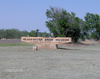
We visited this museum with artifacts, bones and geological stratta samples from a dig site just south of Clovis. The curator, an archaeologist, was a very interesting person. He was more than happy to explain things and talk about his field of expertise. The Blackwater Draw is one of the most well known and significant sites in North american archaeology.
Jaw bones and teeth from a Mammoth found the the Black Water site.

Foot bones of a Mammoth found in Blackwater Draw site.


ALBUQUERQUE, NM


Statue at the edge of "Old Town" a grouping of old buildings and houses used for shops, art galleries and restaurants.


A convent/church in "Old Town". A very well maintained and beautiful building.


These statues are in front of the Museum of History & Art across the street form the american Atomic Museum. Since we were tired and hungry after visiting the American Atomic Museum we didn't get to it or find out who they represented.


We visited this museum in Albuquerque. Very interesting stuff.

Any one who is interested in learning more about the Meteor Crater go to meteorcrater.com and click on "experience the impact".


Didn't get any photos in Gallup. Headed to Albuquerque on Monday am.

Monday, May 19, 2008

To Gallup, New Mexico

We drove to a camp ground in Gallup. We spent the remainder of the day relaxing, resting up for the next few day of travel.
Remains of a petrified forest along Interstate 40 heading to New Mexico. The sign has faded so much that it can no longer be read. This must have been a tourist stop at some time.

We stopped at Meteor Crater (still in Arizona), not only a large crater, but a well preserved one. At the bottom of the Meteor Crater is a digging site. The digging is to find shards of the meteor that penetrated the gound when it hit the ground.


View of the Metior Crater through the railing to give a sense of how big the crater is.


A Space Capsule Landing Module just out side the Visitor's Center


The Bear oversees the hitching up process so nothing is forgotten. There is a check list to follow, of course. Then we're on our way to Gallup, NM.


Sunday, May 18, 2008

Flagstaff, AZ, May 16 & 17

We stayed at Black Bart's Camp Ground in Flagstaff, AZ, for two days. The weather here was much cooler that Needles. In fact the night were down right cold.

We had planned three excursions and found a problem with all three. The first stop was at Walnut Canyon National Monument and the problem is explained below. The second stop was at Sunset Crater. We had hoped to get to the top of the mountain and look down into the crater, but discovered that was not permitted. We did see the lava flows. After lunch we went to Lowell Observatory hoping to tour the grounds and see the two old time telescopes, but the grounds were closed due to a wedding.

We ate dinnet at Black Bart's steak house. We shared a prime rib dinner in an Old West atmosphere. The staff sang solos and participated in a couple of group performances throughout the evening and they all had great voices. The food was delicious.

He just had to have his photo taken on the porch of Black Bart's General Store.

The deer at the Walnut Canyon National Monument were not very skittish with all the humans walking by, but they made sure the humans didn't get too close


The canyon floor below the Walnut Canyon Cliff Dwellings.


We had hoped to hike to the cliff dwellings at the Walnut Canyon National Monument, but a very large rock fell onto the only path shortly after the last heavy rain fall. All we could do was hike the short rim trail and see what we could with the binoculars. Since this is a Natinal Park the red tape required to remove the rock is extensive. This is also an important archeological site.


Needles, CA, May 15, 2008, First Day of Trip

The Needle Mountains seen from Interstate 40.
The Bear found a relative at the service station/store where we stopped for lunch. He just couldn't resist showing off his climbling skills.

Our first stop was Needles, CA, at Moabi Camp Ground on the Colorado river. The weather was hot and the swimmers were on their way to the river to swim by 8:30 am.


The Bear looking back at the camp ground


The Bear really enjoyed the view of the river.